The Cruise Maps: Review and Discount Code
(This post contains affiliate links, which means that I may receive a small commission at no extra cost to you)
Read my full review of the Cruise Maps, with an exclusive discount code.
If you’re thinking about buying from the Cruise Maps, then you’re in the right place.
In this blog post I explain who they are, what they do, and explore whether their printed maps are worth the price.
Don’t Have Time to Read This Post?
Use my code ‘JULIA10’ for 10% off your entire purchase on the Cruise Maps website.
Who Are the Cruise Maps?
Co-founded by university school friends Matt and Will, plus YouTube superstar Emma (from Emma Cruises), the brand uses satellite imagery to create 100% accurate printed cruise maps.
Their products range from large framed prints, to smaller A4 sized maps and digital PNG files. You can even purchase a hand crafted album to store your cruise map collection. The brand has recently expanded to include custom cruise cards with specially created albums, and beautiful photo books you can use to remember the details of your trips.
I’ve wanted to get my hands on their prints for a long time, and finally decided to start my Cruise Maps collection with a selection of A4 prints and a matching album.
My Cruise Maps review: Album and 5 A4 Prints
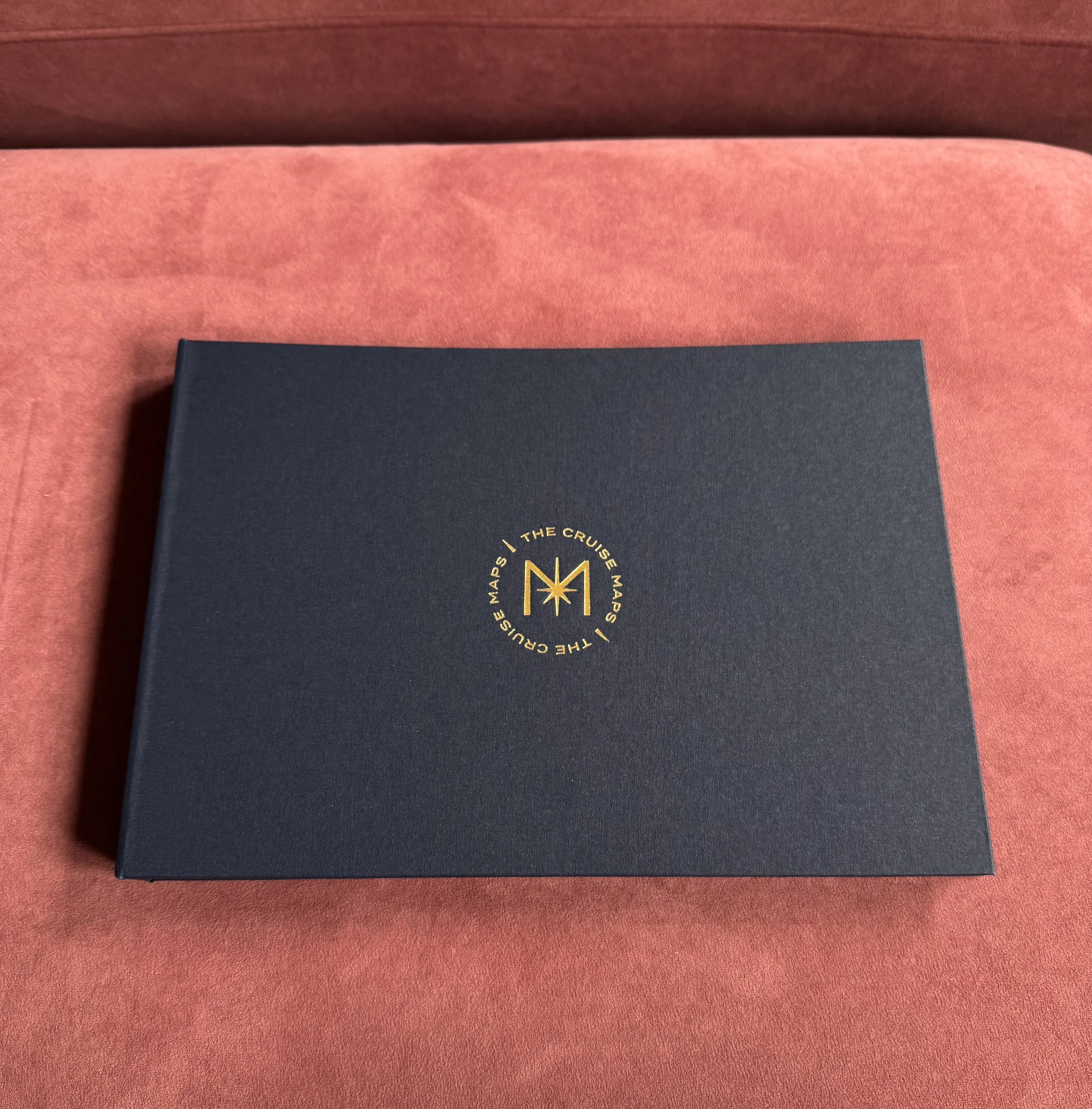
The first thing to arrive was the official Cruise Maps album, which has a luxurious feel that matches its price tag. The outside cover is crafted from Buckram cloth, which is soft to touch and comes in a dark, navy blue colour.
The logo is debossed with gold foil and the entire thing is held together with brass fixtures, creating something that is certain to last the test of time.
Inside the album you’ll find 25 archival quality plastic sleeves, which are designed to hold and protect one map each. I was really pleased to find that the sleeves feel thick and sturdy - a world away from the flimsy plastic wallets I’ve had in previous photo albums from other brands.
Click on the arrows below to toggle between the front and back cover of the album.
The printed maps arrived around a week later. These take slightly longer to produce as the satellite imagery is checked by their in-house team to ensure they are 100% accurate, and printed on demand.
I was pleased to find that the maps use high quality 200gsm fine art paper, with a matte finish, and were safely sealed within a triangular cardboard box. This kept them in perfect condition - all I needed to do was unroll each print and slide them into the album.
Note: The instructions say to unroll the prints and flatten them before placing them inside the album, but I’m impatient and found that they were fine if I put them in right away.
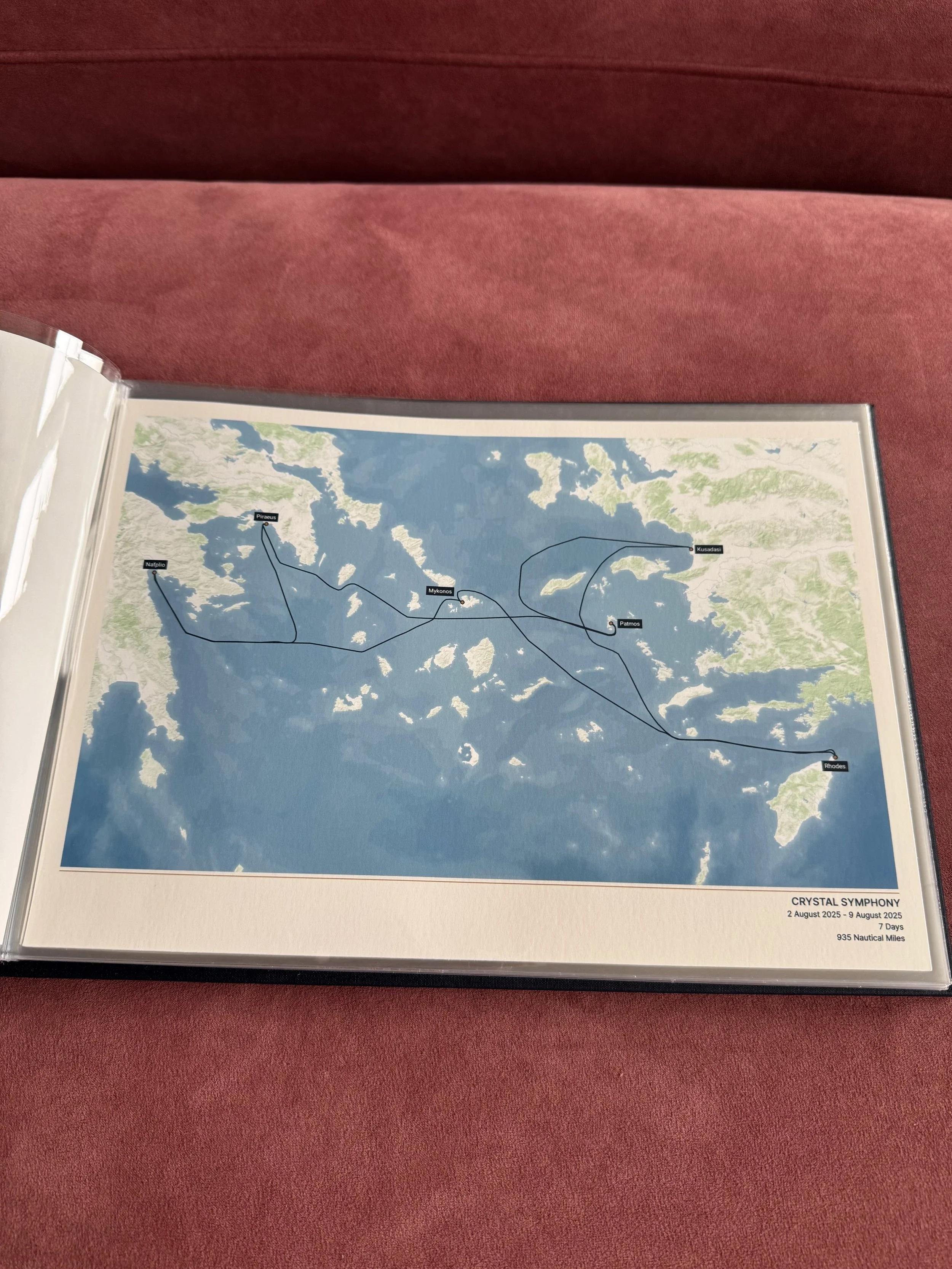
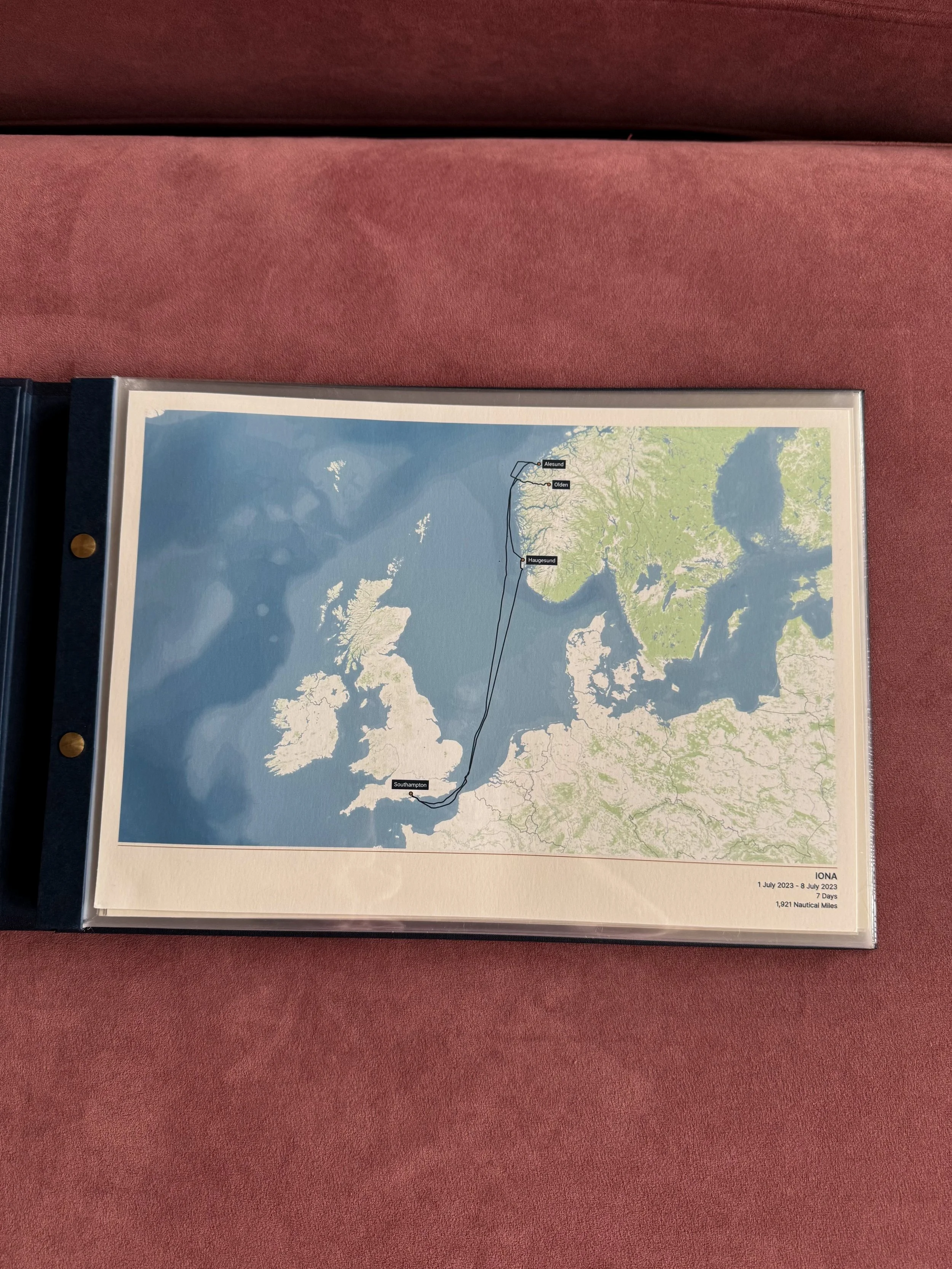
I liked how each map had been printed in full colour, with the name of the ship, dates of the sailing, number of nautical miles covered and number of days sailed, detailed in small print in the bottom right hand corner. This makes it easy to recall the details of each trip.
Again, use the arrows on the image below to browse through my first collection of maps.
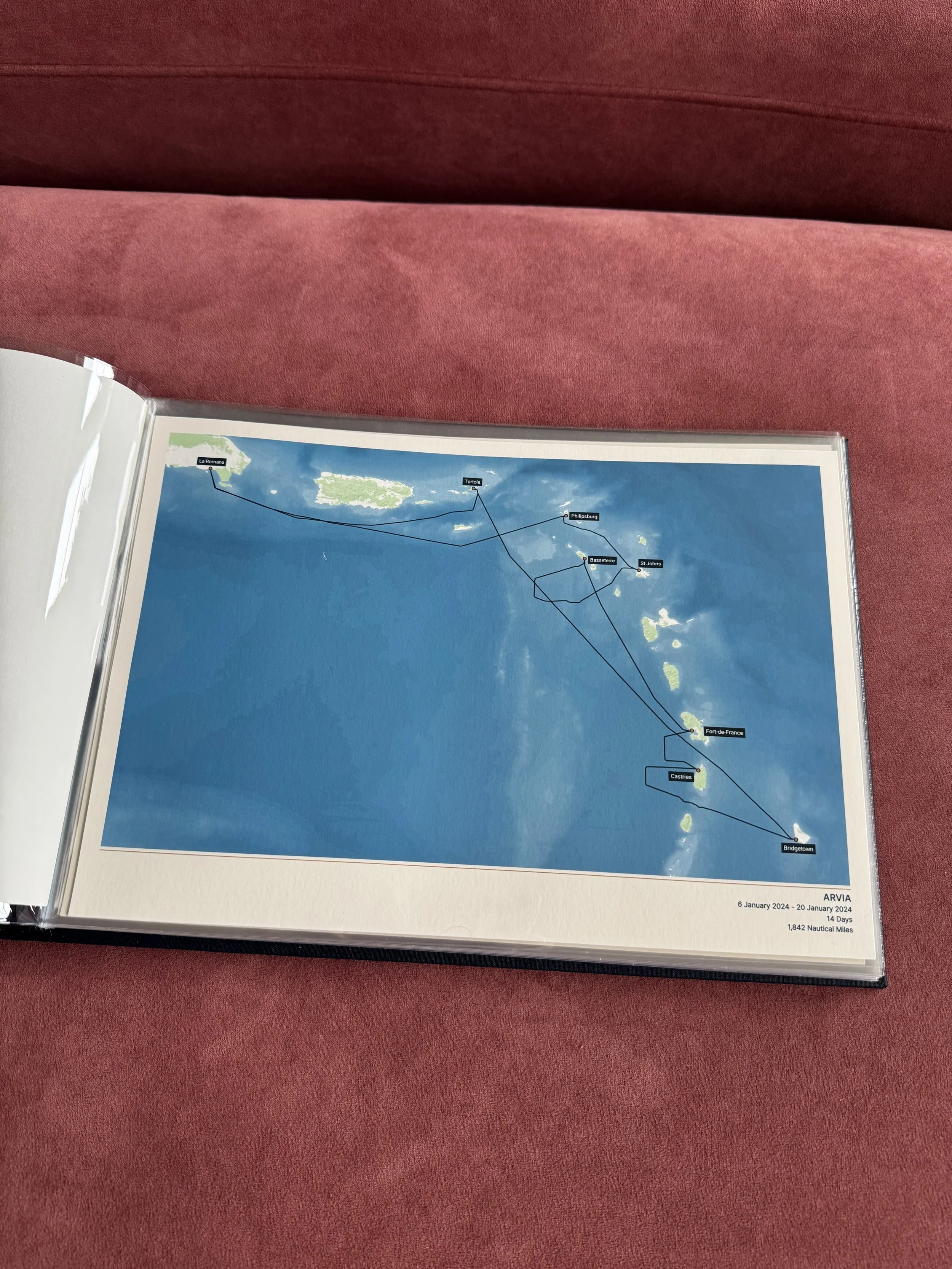
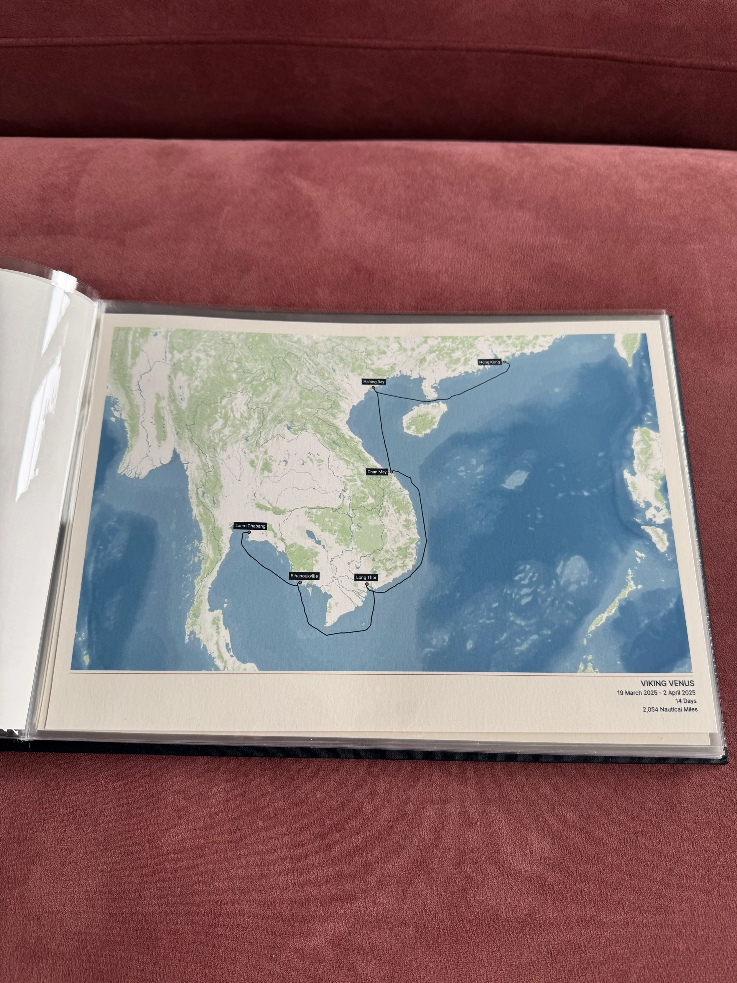
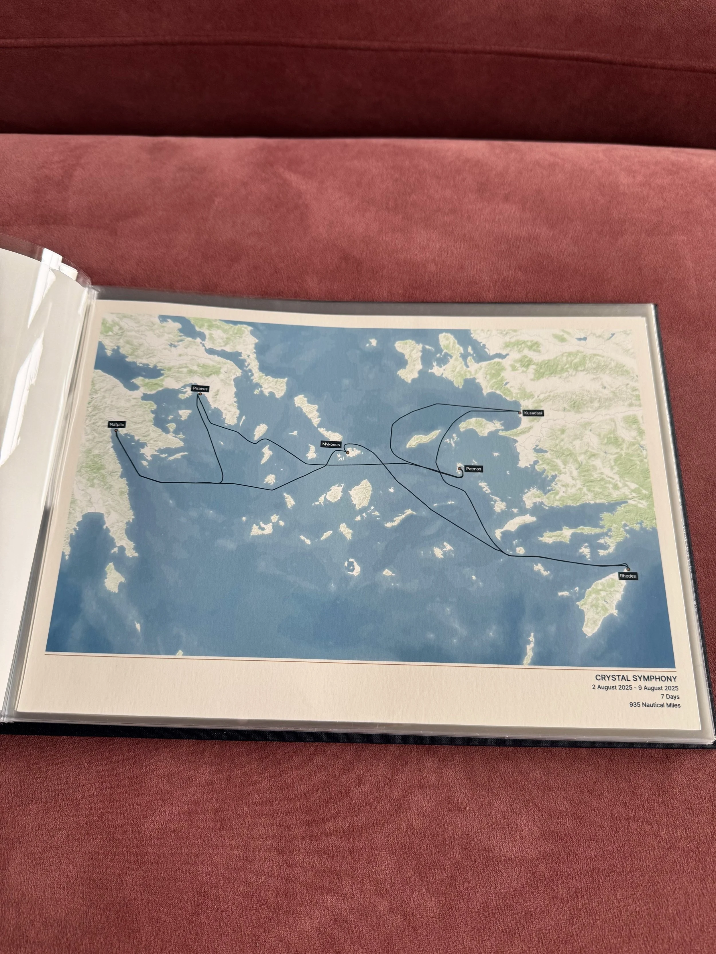
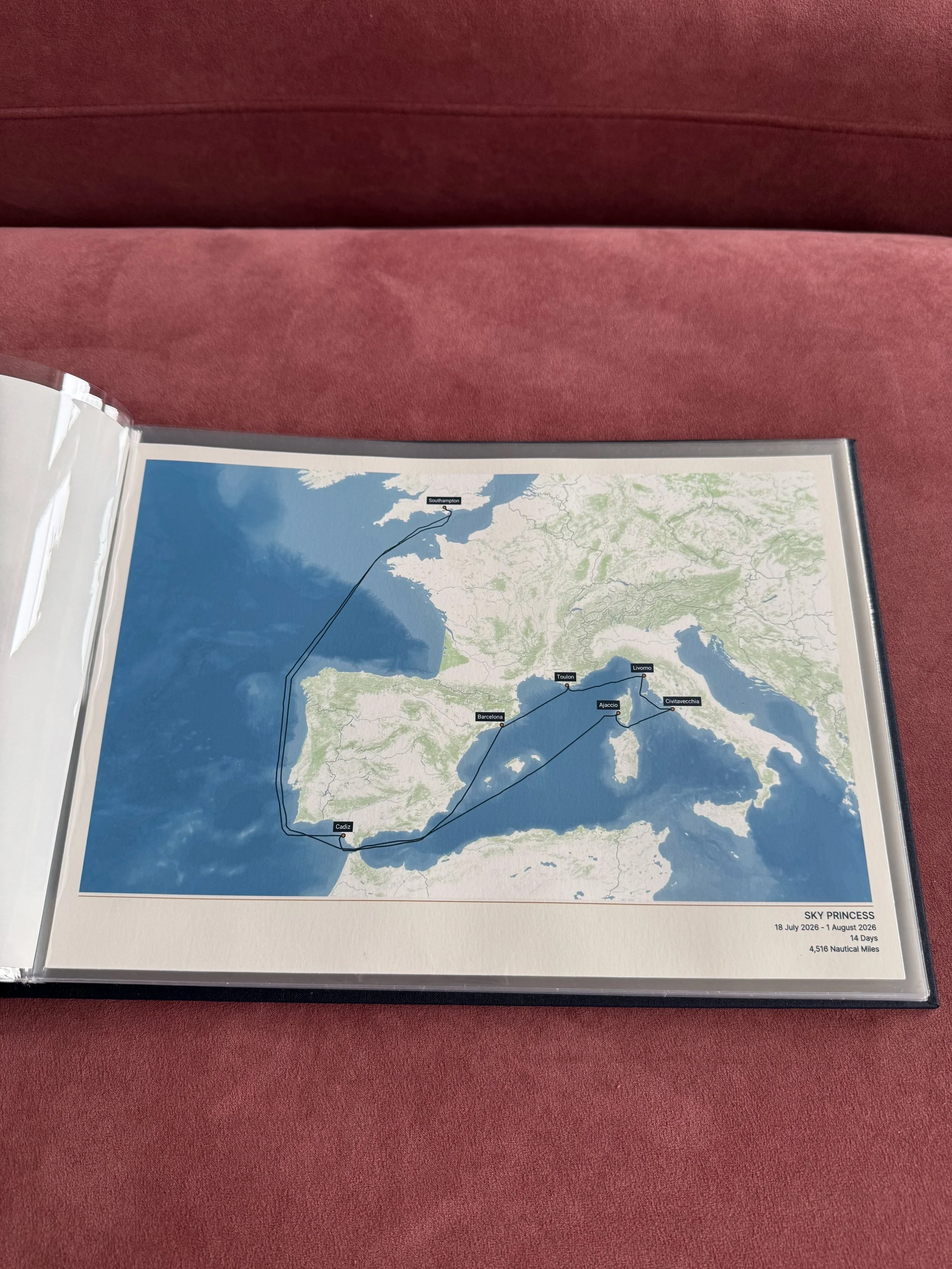
Pricing
These cruise maps are a premium product and as such they are priced accordingly. The Cruise Maps album currently costs £70, which might seem a little steep, but it reflects the high quality craftsmanship of their UK based manufacturers.
The maps themselves vary in price depending on the size and format. The A4 prints that I purchased currently cost £40 each, while the 30cm × 40cm maps cost £48 and the 45cm x 60cm maps cost £54.
If you’re on a budget, you can purchase the digital files for £30 each and arrange the printing yourself. You can even add the digital files to your printed order for £7.50 per map.
I took advantage of the Cruise Album starter bundle, which provides a discount for those purchasing the album and a number of printed maps. This costed me a total of £200 for 5 printed maps with a handcrafted album.
The Album Starter Bundle Explained
Currently, you can get 50% off a Cruise Maps album when buying 3 A4 prints, or a free album when buying 5+ A4 prints (this is the option I went for). I have sailed on more than 5 cruises so I just chose my favourites for this purchase, and plan on adding to my collection and buying the rest at a later date.
Don’t forget to use my discount code ‘JULIA10’ for 10% off your entire order on the Cruise Maps website!
Free worldwide shipping is available for all of their products.
Are The Cruise Maps Worth Buying?
In my opinion, yes, these maps make wonderful gifts or personal keepsakes for anyone who enjoys going on cruises. Looking through my album brings me so much joy, and it’s a great way for me to visualise how far I’ve travelled around the world!
Although the products created by the Cruise Maps do come with a high price tag, this really does reflect the quality of the items which are entirely handcrafted and printed within the UK, with a specialist team who check all of the maps individually.
In the future I really want to add to my collection and buy one of their cruise card albums. I keep the cruise cards from all of my trips, and these specially made albums seem like a great way to store and display them. I particularly like how the the brand prints their own cruise cards as well, which will be ideal for filling any gaps in my collection.
For example, Princess Cruises no longer issue cruise cards, instead providing their guests with wearable medallions. I’d definitely like to buy a Cruise Maps card so that my wonderful Sky Princess trip can be recorded as part of the collection.
If you’re on the fence and are still trying to decide whether these maps are worth the money, then I’d urge you to go for it, and create a special keepsake you’ll treasure for years to come.
Ready to purchase Your Cruise Map Prints?
Use my code ‘JULIA10’ for 10% off your entire purchase on the Cruise Maps website.
Frequently Asked Questions
How does The Cruise Maps work?
The company uses satellite ship-tracking technology to create custom made maps that show the exact route of your cruise, rather than the itinerary created by the cruise line.
Can The Cruise Maps recreate an old cruise?
Yes! This is essentially what the brand specialises in. All you need to do is provide the name of the ship, along with the dates of your trip and the start and end points. The team will then be able to print the data and create your bespoke map.
Note that any cruises completed before 2015 will use a presumed route - their team will be in touch to collect additional details.
Can I customise my Cruise Maps print?
There are several customisation options, and each map can be given its own title. You can also add special occasions and additional markers to each port, such as engagements or birthdays. To make sure it’s included, contact the team hello@thecruisemaps.com when you place your order.
How accurate are The Cruise Maps?
These maps use satellite ship tracking technology to show the exact path that your cruise followed, so you can see any anomalies or amendments that are unique to your trip.
Any cruises you’ve sailed on previous to 2015 will use a presumed route.
What if my cruise ship or itinerary isn't listed?
The Cruise Maps list hundreds of ships and thousands of itineraries, but if you can’t find it on there, their team will look into it for you. Just contact them on hello@thecruisemaps.com.
You can even pre-order maps for cruises up to 2 years before sailing, to arrive after you return.
More Blog Posts
Sky Princess Honest Ship Review
Queen Mary 2 Ship Review (Pre-2027 Refit)
Nordace Backpack Review: My Go-to Piece of Cruise Travel Hand Luggage